At The Sea Wall

My friend at the sea wall
The heat radiated from the stones and sand and sapped us of our energy. Even our talk was lazy...inconsequential comments, meandering thoughts, broken bits of memory.Oh, sometimes we were serious as we two are prone to be, but we also talked about the addictive nature of those honey-mustard pretzel pieces I'd carried as a snack, and boys we briefly dated, and how walking barefoot on gritty surfaces is like getting a wonderful foot massage. (Well, not for me, a city-bred kid, still sitting in my sneakers.)I admired the sea wall from aesthetic angles, thinking about its initial purpose and utility, wondering about its history and the complexities of building it.
I later found reference to it in a 1916 guidebook written by Joseph Silas Diller (and others) who worked for the U.S. Geological Survey from 1883 to 1923. In this particular book Diller was describing the Shasta and Coast Line railroad routes and the land these cut and follow, so richly observed it read like a poem to me. You can understand how I got sidetracked, but I present the following excerpt, a geological perspective on our neighborhood.

Point Conception Lighthouse, 1916
North of Elwood is a famous olive grove and oil factory. West of Elwood some of the larger streams from the mountains have gashed the terrace which the railroad is following, and some beautiful views of ravines and sea may be enjoyed from the car window. This is particularly true from Bell Canyon west to Gaviota (Spanish for sea gull). The larger canyons cut back into the mountains, exposing the several southward-dipping formations in series. The light-colored rocks in the main range are Topatopa, the reddish rocks in front of them Sespe, and the shales along the lower hills, forming the foundation for the terrace, are Vaqueros and later beds of the Monterey group.
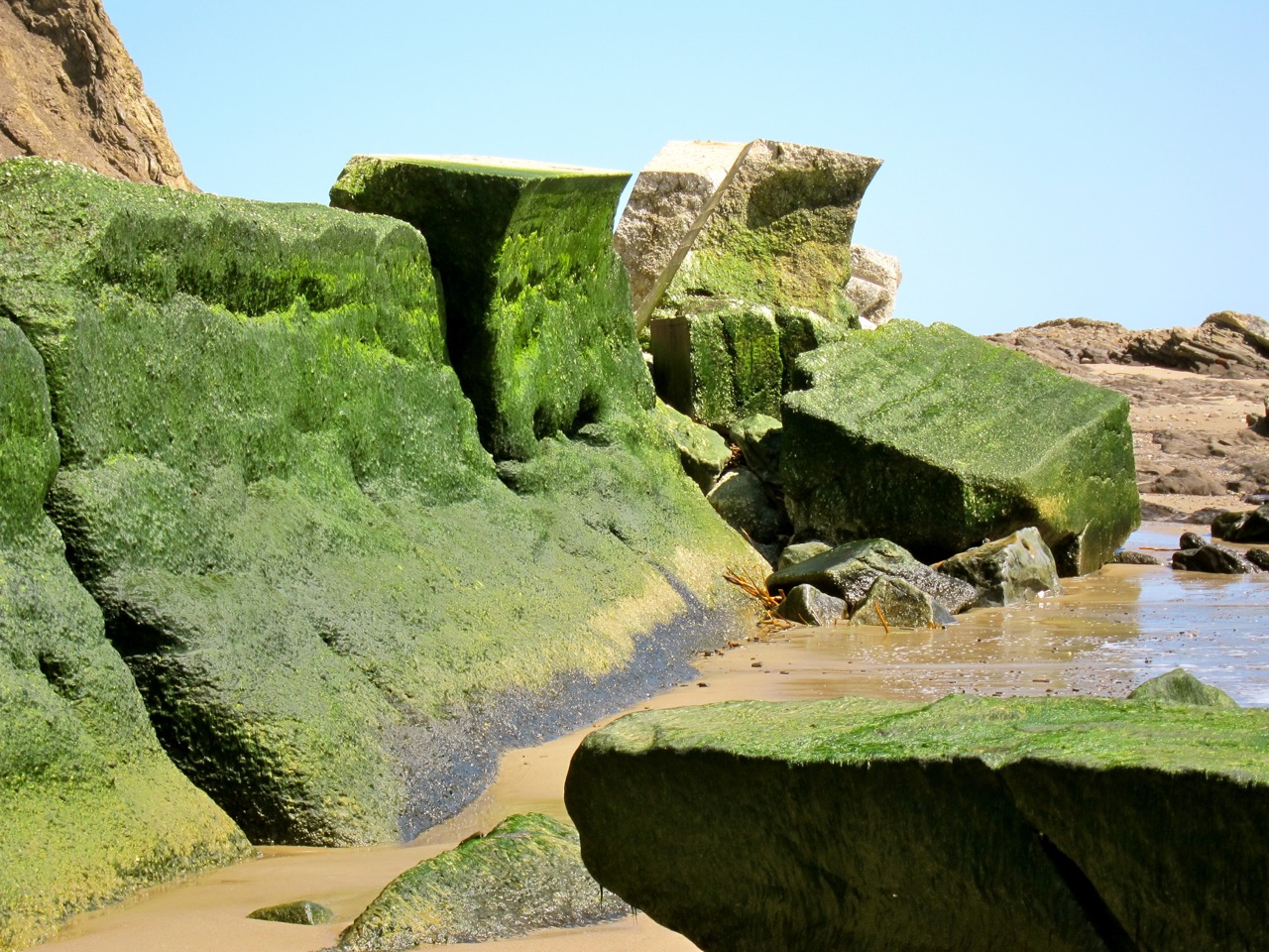
Naples and Capitan are small places beyond Elwood. From Orella, the next station, to Gaviota and a little beyond, the Monterey shale beds along the coast are very uniform, having a southerly dip of 30 to 45 degrees. They are well exposed along the foot of the sea cliff at low tide. The straight shore line along this part of the coast is due to the uniform trend or strike of the beds and their steep seaward inclination or dip, which render them very resistant to the attack of the waves. Nevertheless, at a number of places between Tajiguas (346 miles from San Francisco) and Honda (Spanish for deep, 310 miles) the railroad company has been compelled to build a sea wall of concrete.
At several points the low terrace which the railroad follows is covered by boulders from the hills immediately to the north. In the vicinity of Gaviota these hills come close to shore and a good view may be had of the coarse, steeply inclined sandstones.At Alcatraz (meaning pelican) on the right (north) there is an oil refinery to which oil is piped across the Santa Ynez Mountains from the Santa Maria field.From Gaviota nearly to Point Conception the rocks dip south and at El Cojo (Spanish for cripple), 11 miles beyond Gaviota, the shale beds dip north, indicating some complications of structure at the pronounced bend in the coast which forms Point Conception. The shale extends northwestward from Point Conception to the Lompoc Junction.
The windswept country near Point Conception is devoted to the raising of cattle and hay. On the point are a lighthouse and a life-saving station. From Carpinteria to Concepcion, a distance of 56 miles, beautiful views are obtained of the Santa Barbara Islands. The intervening channel is shallow and, with the islands, belongs to the continent rather than the ocean. Beyond the islands the depth of the water increases very rapidly, and this steep submarine slope, which if it were land would appear as a large cliff, marks the real boundary between continent and ocean.The slope has probably been formed by faulting as the continent rose. It runs north and south off Point Conception and determines the abrupt change in the trend of the coast.
IMG_0050
I got tired of typing and stopped before Jalama, but I do find this stuff fascinating. And meanwhile, back at the sea wall in its present day incarnation, I thought about how wind and water and weather have shaped it into art, and how time seems to be melting it like Salvador Dali's clocks, and how we in our impermanence would do well to transform into beauty before we disappear.The sun continued to beat down on us. We sipped at what little water we had left, contemplated the long hot uphill walk back to my house, and wished that we had driven to the beach like reasonable people.
And then my friend did the only thing that made sense. She took off her dress and ran right into the ocean for a swim. It looked refreshing. I removed my shoes and waded.